


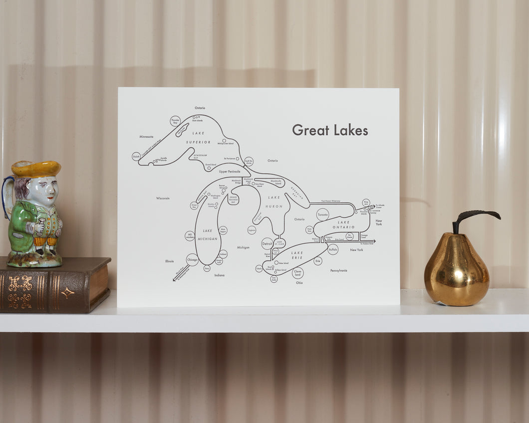
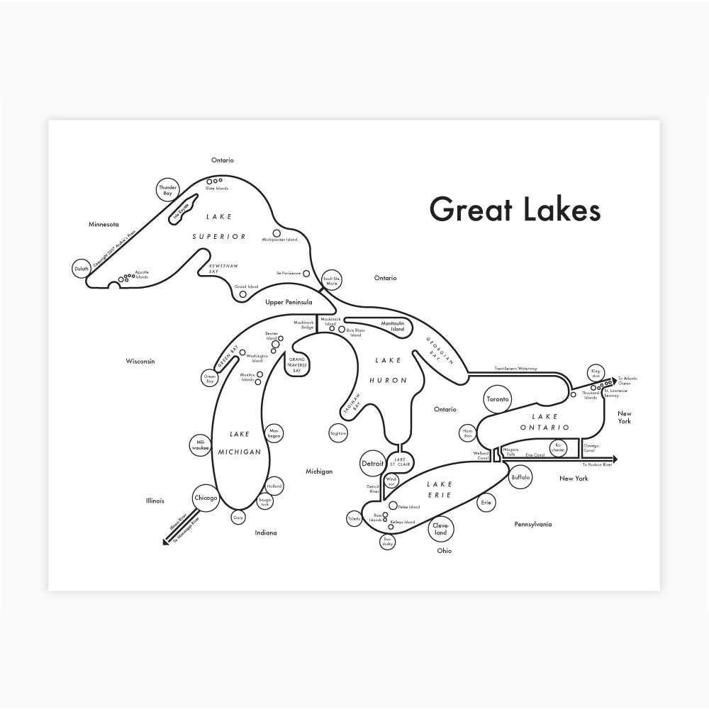

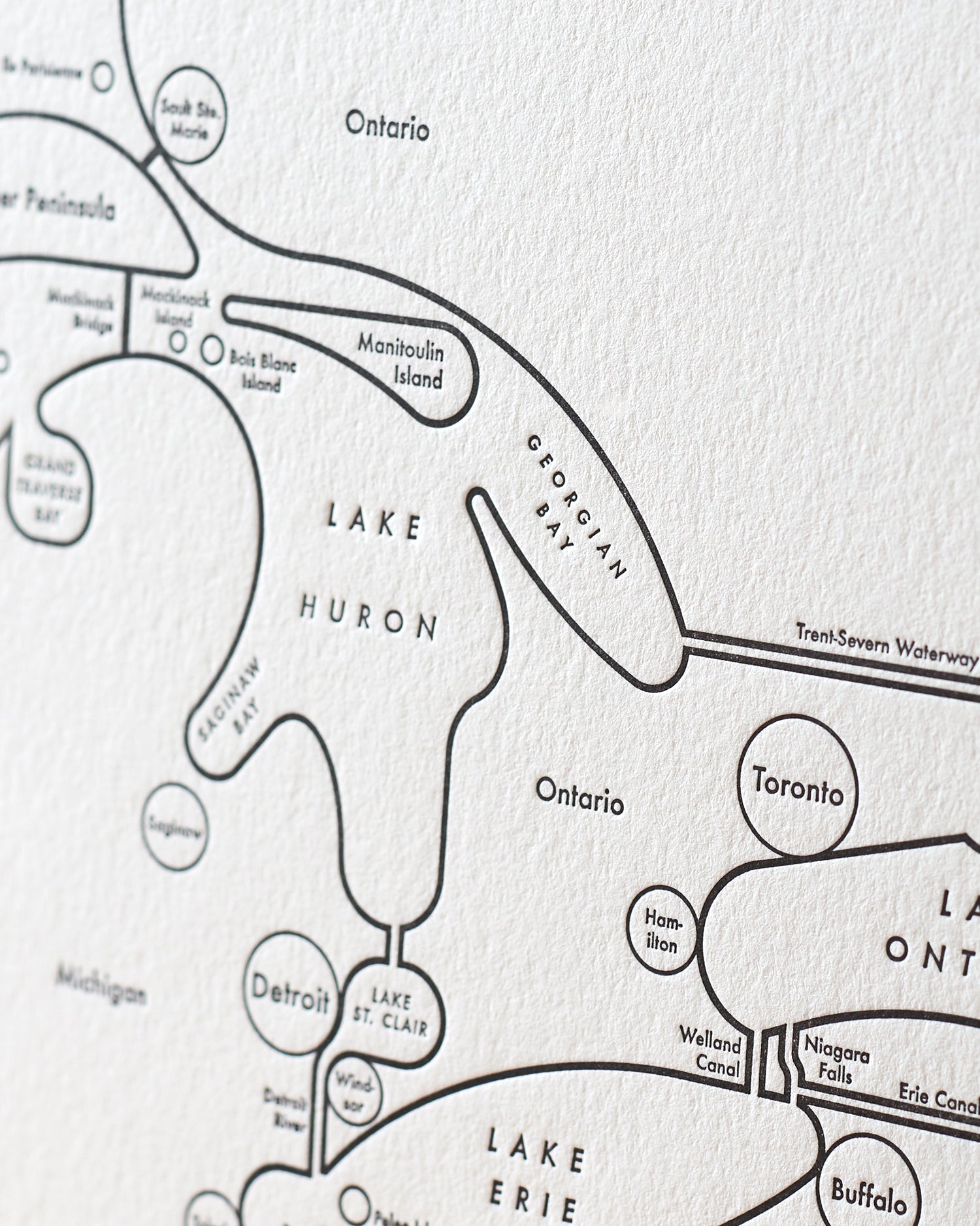
The Great Lakes Region is one of the most robust and beautiful areas of North America. I wondered what it would look like to make a map from the lakes' perspectives. What towns and cities mean most to the lakes, and how is everything connected? We usually cut them off at the USA/Canada border, or alter the lakes' shapes with the state boundaries.
ABOUT THE IDEA
Information is more fun to read when it's beautiful. I've designed these charts and maps with hours of research, reassembling data into a brain-friendly aesthetic. I edit the information significantly, avoiding the "dazzle" effect which occurs when our eyes are battered with too much information. Letterpress makes it even more gorgeous.
ABOUT LETTERPRESS PRINTING
Letterpress is a very complicated and expensive printing method that I am obsessed with. All letterpress prints are slammed with 600 pounds of pressure, creating a deep, tactile texture. The ink gets embedded into the thick soft paper so it won't fade within your lifetime. Read more about letterpress printing here.
Your local frame shop is going to do a better job than anyone else. There's a reason this craft endures and cannot be automated: It's skilled work that is best done face-to-face in physical space.
See more framing ideas here.
Copyright 2020 Archie's Press