


So there's a lot to unpack here.
My main thesis was to explain the Big Picture of the subway system, describing the general arrangement of the system. This is probably more useful/endearing to a person who has used the subway a lot. I conceived this about six months after moving to the city, when I still had the eyes of a newcomer, but the knowledge of a regular passenger. I've been working on it obsessively for hours at a time, for about four years.
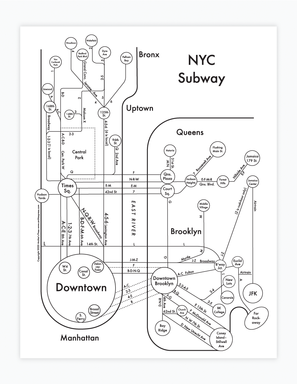
The Strategy: Strip away individual stops and keep everything referring to two things:
1.The terminus/direction of each train line.
Often, the directions for each train are referred to by their last stops. For instance, BDFN & Q trains all have Coney Island/Stillwell Ave as one of their directions. If you don't know what that means, it helps to see, highlighted, CONEY ISLAND/STILLWELL AVE. You'll see this a lot on the signs in the subway, so it's nice to know what it refers to. It means "South Brooklyn direction".
2. The street that each line follows.
There's a disconnect between the subway, underground, and "reality" above ground. We exist to live above ground, not underground, so I felt having a little knowledge about where the underground paths take you can give you some more agency over your experience in the subway. Some lines do not follow a logical street so I didn't name them.
Copyright 2020 Archie's Press